Tuesday, April 5, 2016

WInd River Range- Titcomb Basin new routes

In July 2015, I joined a team of Salt Lake City climbers who were returning to Titcomb Basin with some unfinished business of a failed new route attempt on Fremont, due to the conditions they endured the previous August. Unlike them, I had no agenda, only to be apart of this expedition, and to climb the highly acclaimed, impeccable granite that resides in the Wind River Range. In fact I hadn’t even talked to any of my friends about routes we wanted to repeat, or the potential for new ones. I was merely going off the hype of my friend Shingo Ohkawa and that was all I needed. Lucky for me, Greg Troutman was in the same agenda-less boat as me, so we teamed up to make a couple of first ascents.

Ranger friendly camp, sort of.


Crows Nest camp 

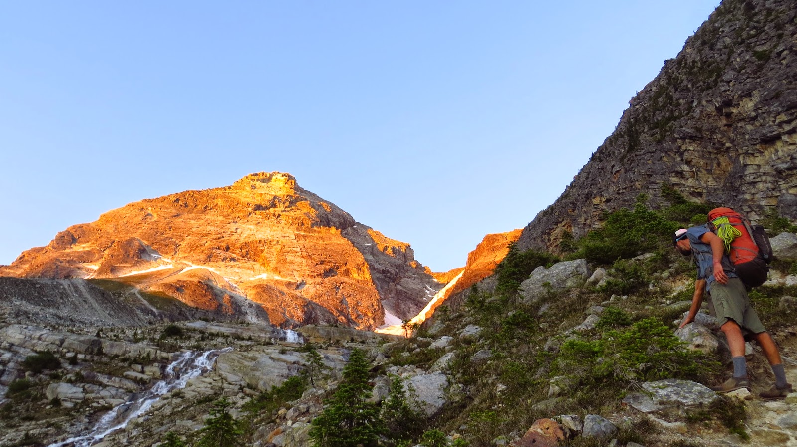
The endless West Aspects of Titcomb Basin
Mt Helen stands proud at the back of the basin
 The trip started off early on July 17th, when we met the horse packers from Mule Shoe Outfitters at the Elkheart Park trailhead and began our single push to Island Lake, 12 miles down the trail. We set up base camp at the east side of the lake. “The Crow’s Nest” as we called it, was a prime, centralized launch point for our objectives. It took us another day to make camp cozy, efficient and “ranger friendly.” On day 3, Troutman and I set out for our first mission in Titcomb Basin.

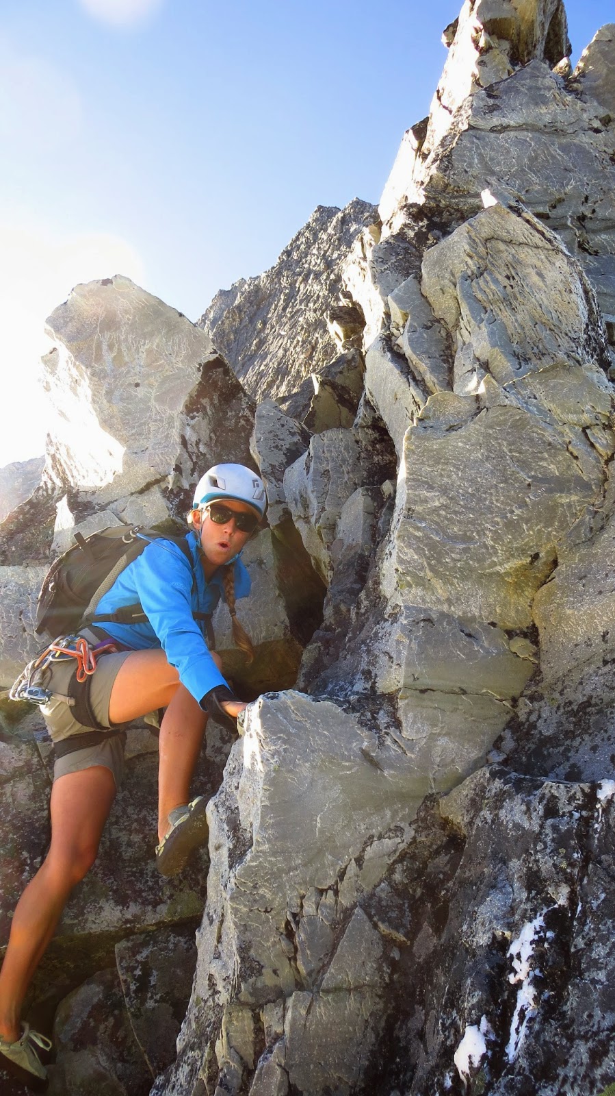
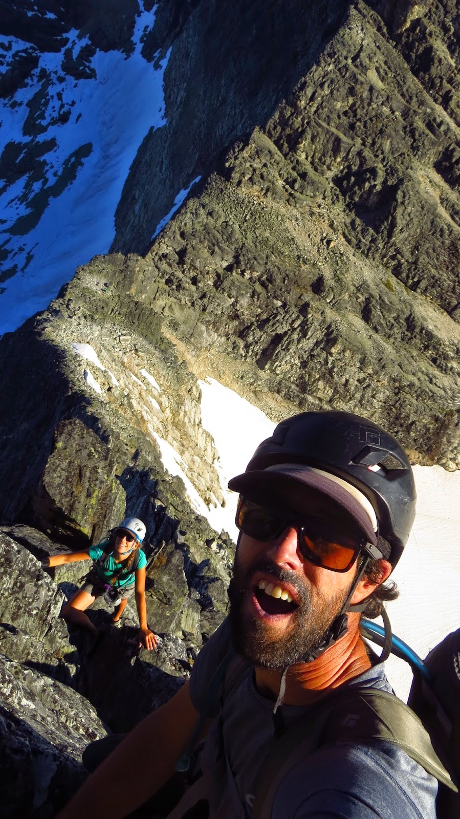
Me and my new friend
On July 19th, we opened a new route on the Red Tower which sits just below Fremont’s West Face. We climbed an independent line on the left side of the tower staying just to the left of the long arête (Red Tower Arête - Mark Jenkins, AAJ 2012). The route starts at the lowest toe of the Tower. After a steep, balancy start to get to the main crack system we found solid rock and climbed moderate cracks and corners going practically straight up for 5 pitches. The final pitch was the crux at 5.9+, stepping left into a thin corner, past some intricate flakes to an amazing steep finish that put us on the summit ridge. We found one rappel anchor, but ended up down climbing into a loose gully, then traversing back under the tower to the base. We named our route, “Red Eye Gringo” (700’ II 5.9+) for the foreign feeling we had while climbing for the first time in Titcomb Basin. The rock sure is pretty up there, and unlike any other alpine areas I have climbed.

Red Tower


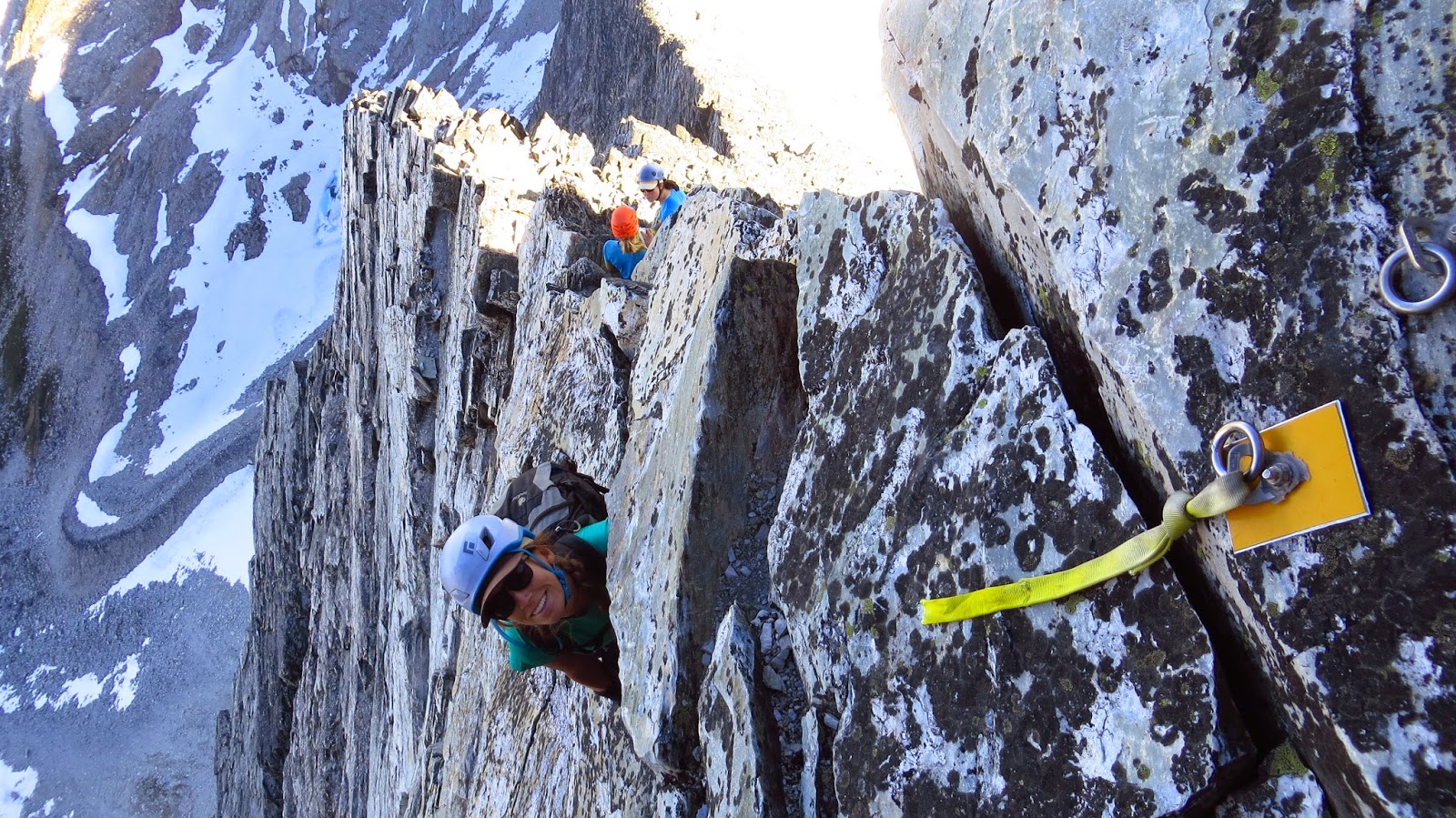
Troutman topping out the Red Tower

The next day we went into Indian Basin to look for route potential on the Northwest Face of the Elephant’s Head. According to our old guidebook, the wall was home to at least 3 routes, none being harder than 5.9. We were keen to find something a bit harder. Our route “Poachers” (6 pitches 5.10) starts up a 20 foot, thin splitter that is the crux to the route. It was tricky to protect, but some small cams did fit in the “butt crack” splitter. The second pitch moves up and out a spectacular 5.10 tight hand crack through short roof. 3 more pitches of 5.8 got us up to the final juggy chimney. As we walked off to the South, we noticed some fine looking crack climbs. Troutman started up one of them, but the weather came in, and we bailed by down cleaning.

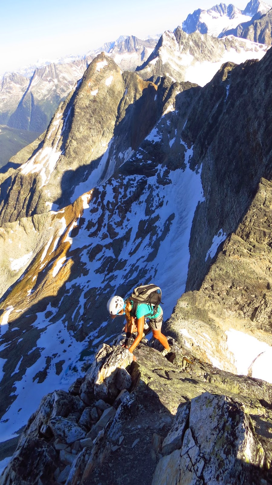
Trout on Elephants Head Buttress

On our third day in a row of climbing, Troutman and I attempted to repeat Indian Paintbrush (12 pitches 5.10, Oliver Deshler-Mark Jenkins, AAJ 2012) on Sacagawea. Half way up the wall, we got off route. After recognizing our mis-position, we decided to just push forward, hoping to find a new way to the top. After a few bold pitches that linked together some epic crack features, we hit an impasse. We bailed by traversing right, then rappelling over to and down what we believe was the route “West Face Right” ( Michael Kennedy-Chris Lundry 1976). We left a few nuts and one red c3 to get down. Judging by what we saw and experienced, there is definitely potential for hard, exciting routes on the upper face of Sacajawea.

West Face of Sacajewea
Our route "No Obligations" goes up the middle of the left pyramid formation


Trout following up our final push on Sacajewea
We bailed shortly after this stopped by blank and steep sections

Soon after, Troutman had to leave. But another partner in our massive rotating crew from Salt Lake, Kevin Chuba, hiked out and was psyched to do some climbing after his solo ascent of Gannet. After a couple days of cragging around camp, and climbing the classy “North Arête” (5.6 III, Fred Beckey-Patrick Kellis 1970) on Ellingwood Peak (aka Harrower Peak), we walked into Titcomb to have a look at the east face of The Buttress for new route potential. This formation
sits near the head of the basin, directly across from the intimidating west faces of Helen and Sacagawea. After enduring so much shade on this trip, we were happy to finally be climbing in the sun! From the bottom of the wall we noticed a wide crack/chimney feature at about ¾ height, that we dubbed the “Buffalo’s Mouth.” This was the feature that we used to guide us up the wall. We named our potentially new route “Out of Oats” (8 pitches 5.9). The climbing goes as follows; smooth slab (5.5), nice corner (5.7), easy slab and crack stopping at a green crack (5.4), up the green, lichen covered crack to the base of a roof (5.7), move right, around the roof to a finger crack corner (5.9), a little runout to the base of a wide crack (5.8), the Buffalo’s Mouth pitch, a nicely protected chimney (5.9), easy, but very loose climbing leads to the final gully where we unroped for the scramble to the top. We descended towards Summer Ice Lake.

Kevin Chuba on Ellenswood Ridge
Mega classic 5.6
On July 29th, our last full day of the trip, I teamed up with Mark Evans to give Sacajawea another shot. Its West Face was way too impressive to not attempt again. After Mark somehow dropped one of his digital cameras into the latrine after breakfast..., we got an alpine start and set off one last time into Titcomb Basin. 

We arrived at the base of Sacagawea around dawn and headed up the first 4 pitches of “Indian Paintbrush.” At the top of the chimney, where Troutman and I got off route, I spotted the fixed nut with a purple sling described by Jenkins in the 2012 AAJ, so I stopped and set up a belay. Mark took the next lead, the obligatory 5.10 traverse, climbing up and left, passing the fixed nut, which we left as a route marker, to a ledge about 25' away. From here, we believe that the original line continues left to a larger left facing corner system. 

Instead, Mark climbed straight up passing a large flake, then up a left leaning, slightly overhanging lay back corner to a belay below a steep wall with many cracks. I continued straight up the "bloody knuckles" pitch, climbing fantastic hand and finger cracks/flakes, then up some exposed stemming moves below a steep overhanging corner. After continuing to push myself into the unknown, I had to rest on a cam in order to replenish the go juice needed to finish this sustained pitch. Mark followed the pitch clean and felt that it was about 5.11-. 


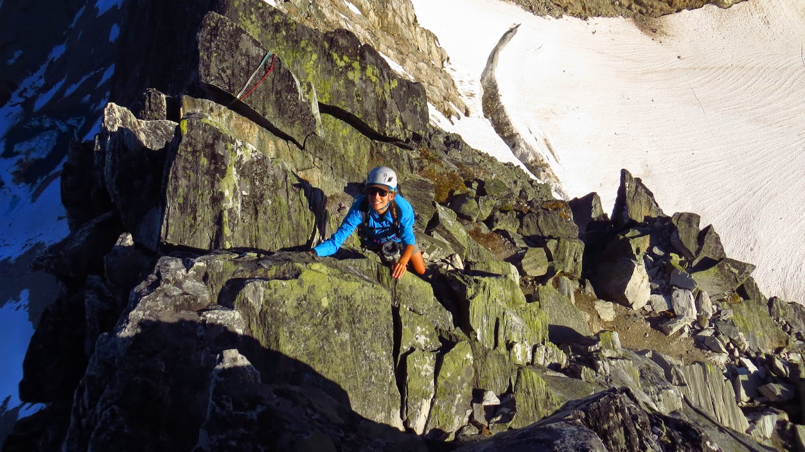
Mark following the "bloody fingers" pitch
during our first ascent on Sacajewea


The next pitch was an amazing find by Mark. It was a bit traversing and indistinct, but always headed up. He climbed right then up over some roofs, disappearing and reappearing a few times, yelling with determination to find a way to continue up the wall. He built an anchor on a small ledge below a nice left facing corner. I was happy to be leading another great, solid 5.9 pitch, that headed up and a little right as we neared the top of the wall. Mark climbed another long pitch up to a large ramp feature, then disappeared right, around the corner to the huge, southwestern final headwall. This is where we believe we might have joined the existing routes for the final pitch to the summit. We topped out in the alpenglow with bloody hands and fingers, and tired feet. The views were absolutely spectacular. The glaciers on the north side of Fremont were enormous, and we could see all the way to the Tetons. This was the highest I had climbed on the trip. We scrambled down the North side of the peak, navigated back to our packs, and began the long slog back to the “Crows Nest” for a final night of hot tang and dinner rations. We called our route/variation “No Obligations” (10 pitches 5.11-) because we diverged from "Indian Paintbrush" on the so-called obligatory 5.10 traverse, and also for my agenda-free intentions and expectations that were completely fulfilled on this fantastic trip to the Wind Rivers.
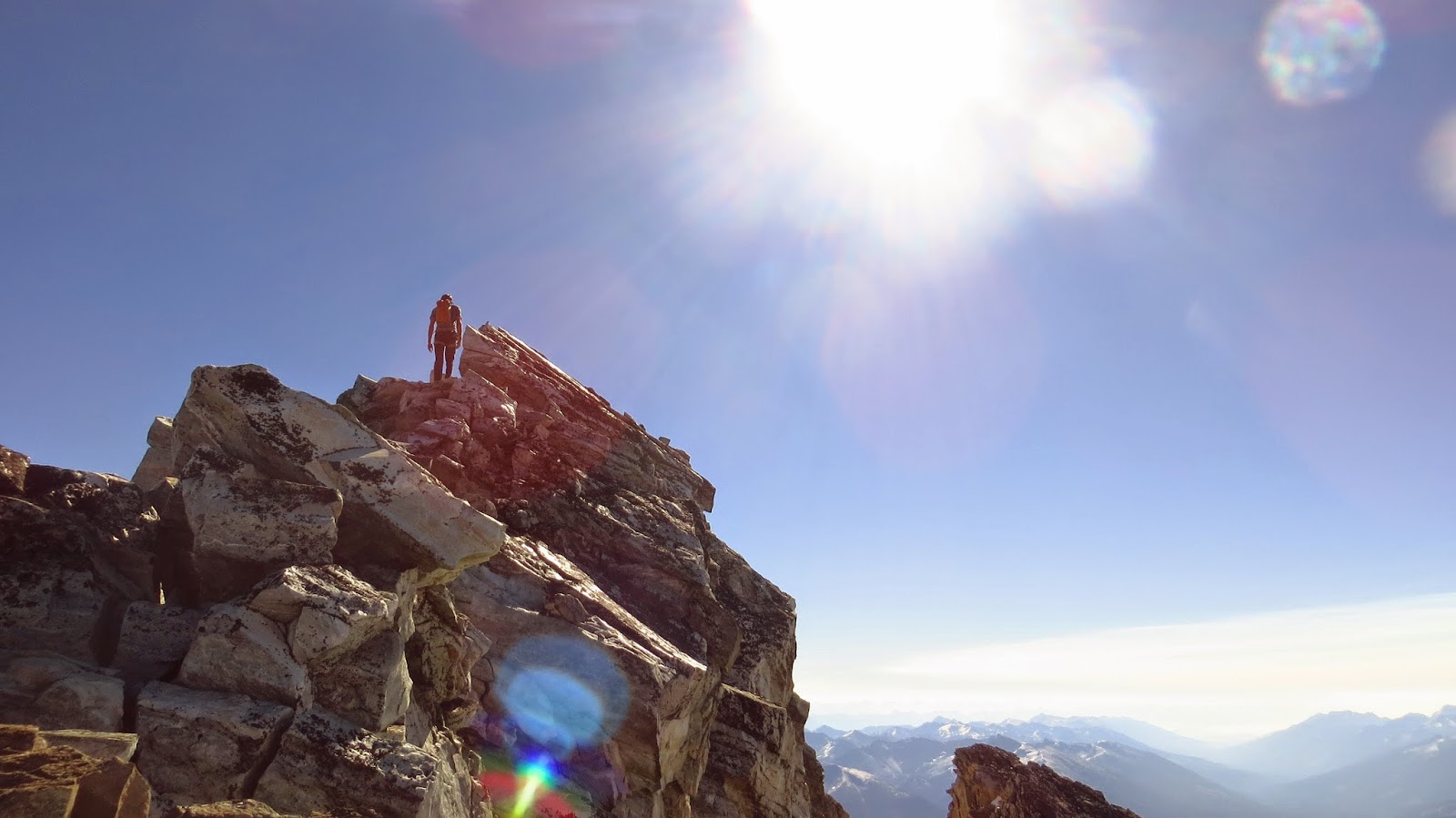
Mark on the summit ridge of Sacajewea
Proud Boyz!
- Jah Buffalo Frerk

Thursday, April 23, 2015

Journey Into the Winds

A little update here from one of the newer boyz in the Salt Lake chapter. 


This is a little video that Greg Troutman put together of a trip Greg, Shingo Okawa, Oli Shaw and I took last summer to Titcomb Basin in the Wind River Range.

Our mission was to establish new climbing routes on the massive granite walls of the 13,000+' peaks that create the continental divide in this beautiful little piece of Wyoming wilderness. Due to an unusually wet and snowy season, we spent close to a month of our lives huddled under a tarp in basecamp at Island Lake... But during a few short weather windows, we were able to climb some of the most memorable ascents of my life.


I know that this isn't skiing, but I think its worth a watch. Pray for snow, and enjoy our...

"Journey Into the Winds"


Saturday, March 21, 2015

Mt. Stimson- Glacier National Park

The SW Face of Mt Stimson in Glacier National Park attracts the eye of many aspiring mountaineers more than any other mountain in Glacier. Seen by every back country skier that has toured along the Middle Fork of Flathead River corridor but skied by few. The daunting task of getting in position to climb the 10,000 foot monster is the main source of deterrence for an attempt to ski the peak.Stefan and I were not to be denied an attempt at taming this wild beast.


Stimsons S Face and SW Face- center line
pc Pete Costain 

After some huffing and puffing about the weather window being there or not we committed to a two day trip. We stationed our vehicle at the Stanton Lake Lodge and walked along the train tracks to find the start of the Coal Creek trailhead that intersects with the Flathead River. We  loaded my pack raft and crossed the Flathead River three times to get our packs, skis and finally ourselves via a tandem row. At 9 am we were dry and skinning up the Coal Creek trail. After only a mile of on trail hiking we got to Coal creek and left the comforts of having a path to follow. We pulled up our pants, took off our boots and forded Coal Creek. From the other side we navigated our way over to the Pinchot Creek drainage.

Stefan tying down the gear
Crossing the mighty Flathead
Fording Coal Creek
Pinchot creek is Long, around 8 miles and protected by thick tress, down logs and steep sides of the drainage. To endure this approach we put our heads down, laughed at the annoyances and took all day to get to the head of the creek. Despite the low snow year we managed to skin the majority of the way in only walking some short sections. We mainly stayed close to the creek bed occasionally heading up on the right bank and into the woods when it tightened up. 9 hours after crossing the Flathead we chose to stop and set up camp for the night below Stimson's SW face at 5,000 feet. We set up a comfy bivy and laid down to rest excited for what the morning would bring.


We slept through the 4 o'clock alarm, but luckily only lost 15 minutes because I checked my watch and it was time to get moving. After an instant b fast of coffee and oats we were skinning up to the saddle between Pinchot and Stimson using head lamps and mountain sense to guide us. At first light we were in perfect position to watch an amazing show of the sun rising over the Glacier peaks. There were a few thin low clouds, but it was mostly clear.


Morning views

Mount Pinchot and Moon

Alpineglow, Stefan and the S face of Stimson
Clad with crampons we booted up the S face which was much steeper and longer than it looked like from below. The snow conditions were great for booting. The snow was pretty deep consolidated powder the higher we climbed on the S face. We were getting giddy with excitement on how good we may be hitting this classic line. A short mixed section of rime rocks needed to be climbed before the summit ridge was reached. By 10:30 we were scoping our descent from the summit, 5.5 hours after starting up from camp. At this time the sun was fully out and the winds were calm as we stood high above many of Glaciers impressive peaks.

more Alpinglow

Booting up the S face
Walking the summit ridge of Stimson
We hung out on the summit for around a half hour soaking in our surroundings. It was awesome to be standing on a perch I have wondered what would be like for so long. By 11 we were getting into position to drop into the intimidating SW face. We down climbed 40 feet through rime covered bulges and stomped out a platform to lock down the skis. We were both confident about the decent after our route up the S face. The first few turns inspired more confidence. There was a few inches of consolidated graupel on top of a very hard surface. Unfortunately the new layer was not consistent along the entire face. Soon we felt gripped as a bullet proof, hard surface was guarding our way through. Evert turn counted. It was a no fall zone. The line has multiple series of cliffs and a fall would send you towards a harsh change of life plans. It was like this for around 1000 feet. We would find some strips of that gripable graupel layer, but then hit the hard surface again readying the whippet in the uphill hand. for a self arrest if needed.

Scoping the line
Wow! that was amazing.
Big Line
Wicked Big Line
Gripping turns.
Whippet at the ready
We navigated the difficult section and were relieved when down lower the sun actually warmed the surface and we were soon ripping some excellent corn. As the surface got softer the angle of the slope became less and we were able to relax and enjoy our position while skiing a classy descent. We whooped and hollered cruising past each other, yo-yoing and riding down canadian style on lower softer portion of the route. It was blissful.

Navigating the cliff section


Finally able to relax!
one last look at the monster.
After finishing the decent we had our long way out on the minds. We stuffed up our pigs and slung 'em on our backs. We were hoping to make it out a couple of hours better than the way in. This didn't really happen. Retracing the route in was not much quicker on the way out. We definitely cared less, but were super tired and beginning to be over the adventure. We pushed hard and fast, splashing through Coal Creek this time with full armor, boots, liners and water up to the knees. The swishy liners captivated my attention all the way to the shore of the Flathead. Our stashed pack raft was where had we left it and just as darkness was covering us we began the first of three crossings back to the road side. Once on the other side we were high tailing it back to the suby parked across from Stanton Creek Lodge.

Overall the trip was amazing! We had an adventure. There was lure, there was mystery, there was doubt and there were us Boyz. We loved it. The only modifications we felt we would make would be to stay out there for 2 night instead of 1. It would have taken some pressure off the day of the descent and perhaps would have led to a run on our up track S face also and getting the SW face in complete corn. I will not be back up in Pinchot creek anytime soon, but when I now drive past the spot on the Middle Fork corridor where you can see the top of Stimson I can only feel proud of our accomplishment.

-Frerkums

Hey friends there's a short amateur video I made for this trip on Vimeo, check it out.  S.B
https://vimeo.com/user38456577/videos


Wednesday, January 14, 2015

Apgar Traverse

Last week we celebrated the Life of our friend Adam Lawton, who 3 years ago on January 6th passed away in an avalanche in Canada. Adam loved being on his skis. He loved pushing himself to exhaustion. He embraced how the mountains can make the human body suffer. In honor of Lawton, Stefan and I chose an objective that He would appreciate. A ski tour that did not include any glorious ski runs, just a long day in the mountains. Where we suffered. I call this tour Exercise Ridge.

The Apgar mountains are a small chain of that sit between the North and Middle forks of the Flathead River. They lie on the Southern border of Glacier National Park. They are not as big or impressive as their neighbors. In comparison the are pretty small. The total distance is approximately 12 miles of walking and around 6,000 feet of elevation gain including the ups and downs along the ridge. There are two Lookout towers that mark the start and finish of the traverse. We chose to go from Apgar Lookout to the higher Huckleberry Lookout. Finishing with a 3,000 foot ridge to ski to our car parked on the North fork road. 


West Face of Heavens Peak
Rarely skied Mega Line
The suffering did not take long to begin. Once we left the Apgar Lookout trail we found out that things were not going to be easy. The fresh snow was not supportable enough to cover the hundreds of down trees and branches. Sometimes it felt as though I was skinning through quick sand while Goblins were trying to pull me under. Maybe they were. I could not see my skis. The initial 2,700 foot climb to get onto Exercise Ridge took us around 3 hours. It was arguous skinning, but we were not to be denied. 

Crossing MacDonald Creek which flows into the Mighty Flathead

Once on the Ridge everything was O.K. again. We began moving along quickly, making up for lost time. The views of the terrain dropping from the ridge were impressive as were the sights of the Southern Park Peaks around Lake McDondald. The hard to get to ski runs made us wish we had more time in the day to sample, but we had a long way to go. We trotted along, mostly with our skins on even for the short descents. Our longest descent from the ridge was 1,000 feet. We ripped skins for this and at the bottom quickly transitioned back to skinning up. With the shortness of daylight this time of year there was not much hanging out during the tour, just progression onward.

Stoked to be above the brush and on the ridge,


Lots of ups and down on the Ridge

Beautiful Scenery and some good looking terrain.

An impressive crown left after the big dump last week.

Too bad we didn't have time to sampling some of the goods back there.
A look at where we were traversing.

Exercise Ridge was longer than it seemed. The 8 summit points we topped tired our legs and watching my watch was a bit anxiety provoking. We crested the final summit just as the sun dipped below the horizon. We quickly transitioned at Huckleberry Lookout and committed to our intended ridge 3,000 feet above the Camas road, which is closed in winter. Headlights moving South on the North fork road gave us hope that this Epic adventure would soon be over.

Looking back to where we had came from.

The never ending Ridge traverse.
Wheres the lookout.

Pretty worked.
The skiing began great and we carved figure 8s above supportable frozen powder. Then the ski adventuring became real as light became darkness and the open ridge became a dense alder forest. We picked our way down, side slipping, holding on to branches and sliding over down logs. This went on for awhile until it became too thick and not enough snow. We kick off the skis and walk down to the valley floor. It wasn't over. We shouldered, threw, dragged and whipped our skis through even more dense alder brush and down logs. I cursed a lot and hated myself for awhile. This was the cause of suffering. I finally crawled up a small mound headwall and onto a flat open surface, the road. 11 hours after beginning this sufferfest.  

-Frerkums

Monday, August 11, 2014

Mt Sir Donald- Rogers Pass


I have wanted to climb Sir Donald since my first drive through Canadas Glacier Provincial Park over the legendary Rogers Pass. On my first visit with Gaelen three years ago the Classic ridge climb seemed daunting and committing so we climbed Mt Tupper instead across the highway. Gazing over at Sir Donald's knife ridge we knew we had to come back.

Gaelen took the train from Seattle to recuperate from a wrist injury she obtained while playing Frisbee and rafting. She iced and rested. After four days of this she felt confident enough to sign up to solo 3,000 feet of 5.4 with me on Sir Doanld. We left on Thursday, driving to Rogers Pass to obtain both the discovery pass and a back country permit. We packed up in the parking lot of the Asulkan Valley campground and headed for Sir Donald by 7:30 p.m. 

We bivied below to Uto/ SirDonal col on a beautiful meadow with running water and an Alpine Lake below. A total of three parties were up there to try the ridge the next day. We woke up and noticed that everyone had already left to begin the climb. We ate and left camp by 7 a.m. When we reached the col by 8 the other parties were making their way up the ridge, it looked marvelous. 

We began soloing wearing harnesses and helmets, carrying a rope in my pack and six long runners with Gaelen. The soloing was so much fun. We just climbed and talked and talked and climbed. It was so different than other climbing days together. It was a blast. The ridge went on for a long time and was so much fun that we actually didn't want it to end. The next false summit was a relief instead of dread because of the enjoyment. We didn't pull out the rope for any part of the climb and passed three parties on route, summiting from the col in 2 hours 15 minutes.

We chose to descend the SE ridge and cross below the summit on loose class 3 scree. This way down is tricky and a little dangerous because of the uncomfortable feeling of loose scree and crossing below climbers above on the ridge. Once we made it back to the ridge proper we continued down climbed to the rappels above the west face. We could have down climbed the entire ridge without using our rope, but decided to try out the rappels because we brought one. We walked back into the meadow camp by 230 p.m. After a refreshing nudey dip in the lake we hiked back to the car. 
  
We did the approach the evening before.
Camped on a sweet meadow below the col
with a small Alpine Lake and running water.


From the col.
We left the meadow at 7 and climbed up
to the col and begun the ridge climb by 8 a.m.

Stoked to solo 3,000 feet of 5.4

Fun moves All the way!

Great exposure All the way!

Selfie on the ridge.

Passing a party of 2 ladies from Squamish.
The yellow rap anchors mark the new and improved rappels

Awesome Views Everywhere!

The ridge Proper.
Solid Rock all the way.


A little break in exposure before the summit.

Where we go skiing in the winter.
I love Canada!

Summit cone : 2 hrs 15 mins.

Happy Buffalo!

Sapphire Glacier and Rampart Mountain in the background


Rapping the West face.
We brought the rope just for this reason.
6 raps.

The Alpine Lake at camp.
Amazing treat to take a dip.

Looking back up the route.
Up the left ridge to the summit and down the lookers
right ridge across the scree face back on the west ridge.

If you like getting into breathtaking mountains and moving fast on moderate terrain, it doesn't get any better than this route. I think that it is the Best 5.4 I have ever done. You can do the entire thing in approach shoes in one day if you want (10,000 feet of hiking/ climbing total). The bivy is nice and makes for a shorter second day. This part of Canada is amazing. The climbing and skiing adventures are multiple lifetimes worth. I can't wait to get back.

= Frerk